Toph said..What I have taken away from your opinions Sirgalivant is that you had never knocked the programmes/software itself, but the practicality of a tablet, and that is a fair enough opinion. what maps software are you using on Mmap? I use the Aus Quickcharts package and if you are using the same, than as you'll be aware the info giving to you is exactly the same as on a chart. Zooming in or out does not give you any more or any less information. Taking away the issue of power supply/power failure, in my opinion the above combo is more than just supplementary. But anyway, that is just my opinion.
MEGAMAX said..
Ah the voice of reason. I think I may get left behind!
I have sextant and know how to use it....as well as a compass, chart and 2b pencil. Oh and a handheld garmin GPS with a tiny screen... My phone has GPS. It is not a toy, it will tell me where I am way better than any sextant, even with horizontal sights or the distance off tables.
My boat is 80 years old and has thoroughly modern solar panels to power the batteries for the bilge pumps. Thats it. No lights, 3hp outboard, oil nav lights which are surprisingly good, gaff rig.
At 5 knots max I am getting left behind by everybody anyway so I just wave and carry on.
Simple but it is enough. Try it sometime, I think you will like it.
Im not sure if you are being facetious or not there Megamaz, but just to clarify, I have no problems (in fact respect) those using an old art form and keeping it alive. Just like those building wooded boats with hand tools. Personally I would use routers and all other kids of power tools

I was just trying to suggest there are failings in the paper charts too (human error and accuracy being a big one) and that one day, paper charts would be done with too. As for your last sentence, I agree simple is good. I like it, I know I do. But I like sailing/camping with my wife and kids and to do that I need a little more mod comforts otherwise they just aint coming

Hi Toph,
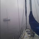
just a gentle dig. My set up is a mix of old and new that keeps me safe. I have a chart chip in the GPS with the entire western seaboard that shows depths, yellow land bits to avoid etc. The WA govt issues really good coastal charts that are way better than the Hydro ones and you can download them for free. Yay WA! I print them in A3 which is about right for my cockpit and if they get wet I have full size below. Print another when I get home.
I only draw 4' and can fix with a compass but features can be sparse around here so the GPS is dead easy. For pilotage a chart and compass is fine. My issue is at night as my eyes are crap so the GPS although small does the job. I use old technology but for safety I have GPS, GPS enabled EPIRB, flares, torch that could cook a roast at 40 yards and ALWAYS wear a life jacket. Not because some little Hitler told me to, but because one would be stupid to have the brilliant technology available today for safety and not use it.
My only shortfall is I have to rely on the charts for depth as I don't have a depth finder. I have to make allowance for this but to anchor I can drop a line to get depth for scope etc.
I think we are slightly off the original topic but I thank it is a bit of Ford vs Holden, Engle vs whatever that other one is, kind of loop. Use GPS, use charts, learn to fix cause its not too hard and could be useful. After all we sail which is arcane anyway, no matter whether wood, fibreglass, steel etc.
I am enjoying the thread as I am always interested in how people solve the eternal navigation question.
I used to work with Morning Bird in another life and he used a chart and pencil to cover lots of sea and come back to mother safely. That was navigation of the highest order.