Caloundra lately

3 years ago
Reply
Register to post, see what you've read, and subscribe to topics.
AusMoz
AusMoz
QLD
1514 posts
QLD, 1514 posts
4 Mar 2025 10:54pm
Lot of sandbanks.
ausbinny
ausbinny
200 posts
200 posts
5 Mar 2025 8:37am
There's going to be a c@#pload of water coming out the next few days - see whats left on the weekend
AusMoz
AusMoz
QLD
1514 posts
QLD, 1514 posts
7 Mar 2025 4:53pm
Low tide- plenty of sand for community sandbags!
Gestalt
Gestalt
QLD
14953 posts
QLD, 14953 posts
7 Mar 2025 5:32pm
Looking forward to windsurfing there after the storm. Just gets better and better
Surfinfreak
Surfinfreak
QLD
294 posts
QLD, 294 posts
7 Mar 2025 8:17pm
AusMoz said..
Low tide- plenty of sand for community sandbags!


People are taking sand off the actual beach, even though there is a sandbag poing less than 5 mins away
ausbinny
ausbinny
200 posts
200 posts
11 Mar 2025 12:08pm
Saw a bit of video (a quick bit from a news network) - looks like not much left of the trees, see how the runoff shapes whats left!
AusMoz
AusMoz
QLD
1514 posts
QLD, 1514 posts
18 Mar 2025 4:12pm


Still the same
mathew
mathew
QLD
2167 posts
QLD, 2167 posts
18 Mar 2025 6:18pm
Good session today - 5.3m + freewave. No sticks in the water, only some trees on the end of the land-mass.

Launched from the Motorboat club - sailed straight across the Bar. Some smooth water and some waves to jump. Could stand up waist/chest deep in most places.
Sailed around the old lighthouse tower. In this pic there appears to be land nearby... that land is now a good 500m further away.


mathew
mathew
QLD
2167 posts
QLD, 2167 posts
18 Mar 2025 6:22pm
For reference. If you zoom in far enough... lighthouse tower is now part of the ocean, some trees in the shallows near the northern-tip.

To avoid the sticks - stay south of the yellow-buoy, stay north of the green-buoy + lighthouse-tower.


AusMoz
AusMoz
QLD
1514 posts
QLD, 1514 posts
18 Mar 2025 8:19pm
It seemed to be shallow the runs from the entrance to the Green marker and that pink float
AusMoz
AusMoz
QLD
1514 posts
QLD, 1514 posts
18 Mar 2025 9:01pm
mathew said..
Good session today - 5.3m + freewave. No sticks in the water, only some trees on the end of the land-mass.

Launched from the Motorboat club - sailed straight across the Bar. Some smooth water and some waves to jump. Could stand up waist/chest deep in most places.
Sailed around the old lighthouse tower. In this pic there appears to be land nearby... that land is now a good 500m further away.


What's all the colours represent?
ausbinny
ausbinny
200 posts
200 posts
19 Mar 2025 9:18am
AusMoz said..

mathew said..
Good session today - 5.3m + freewave. No sticks in the water, only some trees on the end of the land-mass.

Launched from the Motorboat club - sailed straight across the Bar. Some smooth water and some waves to jump. Could stand up waist/chest deep in most places.
Sailed around the old lighthouse tower. In this pic there appears to be land nearby... that land is now a good 500m further away.


What's all the colours represent?


Speed at that point on the map
John340
John340
QLD
3410 posts
QLD, 3410 posts
19 Mar 2025 8:45pm
mathew said..
Good session today - 5.3m + freewave. No sticks in the water, only some trees on the end of the land-mass.

Launched from the Motorboat club - sailed straight across the Bar. Some smooth water and some waves to jump. Could stand up waist/chest deep in most places.
Sailed around the old lighthouse tower. In this pic there appears to be land nearby... that land is now a good 500m further away.


Matthew, what tide would you need to launch a wind foil (with 1m foil mast) from the motor boat club, through the channel, out to sea?
mathew
mathew
QLD
2167 posts
QLD, 2167 posts
29 Mar 2025 11:04am
John340 said..
Matthew, what tide would you need to launch a wind foil (with 1m foil mast) from the motor boat club, through the channel, out to sea?


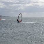
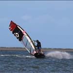
It would be possible to use a foil (ding or sail) in a super-low low tide - the centre channel is plenty deep enough. There are quite a few ding'ers sailing outside the Bar.

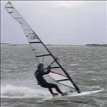
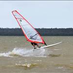
If the wind is South-East to East-South-East then you can easily sail up and down the longest length of the inner channel. You would need to tack-upwind from the launch site, or walk across the shallows (just on the northern side) of the motor-boat club. Then a few more tacks-upwind to sail out through the Bar.

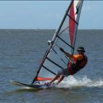
If the wind is SE to Southerly, then no need to tack upwind from launch, just point high to avoid the shallows - then shorter runs on the inner channel obviously.

In other words, iff you are in the middle of the channel, you are good to go.


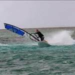
The only time a foil could cross the coastal-sandbar ( as I have shown in all of the tracks crossing the southern edge of the sandbar ) is at high-tide. There is easily waist/chest/shoulder depth in most places. That said, the depth - at high tide - changes very quickly... you'd want to pay attention.
mathew
mathew
QLD
2167 posts
QLD, 2167 posts
8 Apr 2025 9:08pm
Bluey's has had his drone out again - the second breakthrough is now permanent

www.facebook.com/share/v/18d4FnSTj2/
www.facebook.com/share/v/1DLGHZVGgw/
airsail
airsail
QLD
1598 posts
QLD, 1598 posts
22 Apr 2025 11:57am


John340
John340
QLD
3410 posts
QLD, 3410 posts
24 Apr 2025 11:49am
airsail said..


With the main channel heading SE out to sea, the waves breaking on the northern bank of the channel might be very good in a winter SWer
mathew
mathew
QLD
2167 posts
QLD, 2167 posts
25 Apr 2025 10:44am
John340 said..
With the main channel heading SE out to sea, the waves breaking on the northern bank of the channel might be very good in a winter SWer


That is a really good point - I didn't think of that ... will keep that in mind as the Westerlies are just starting to kick in
Gestalt
Gestalt
QLD
14953 posts
QLD, 14953 posts
21 May 2025 2:05pm
latest photos are online from blueys and it looks like northern tip of bribie island all the way to the southern end of pelican waters is gone.


woah... we now have an insane area to play, 2.7km worth

Really need some wind to test it out
Surfinfreak
Surfinfreak
QLD
294 posts
QLD, 294 posts
21 May 2025 6:04pm
Gestalt said..
latest photos are online from blueys and it looks like northern tip of bribie island all the way to the southern end of pelican waters is gone.


woah... we now have an insane area to play, 2.7km worth

Really need some wind to test it out


A lot of the passage is very shallow now, even with a fin. You really have to know where the sandbanks are if you want to commit to a speed run!!
Gestalt
Gestalt
QLD
14953 posts
QLD, 14953 posts
21 May 2025 8:13pm
Luckily I'm not that fast

I did make a sacrifice and bought some lightwind kit. Fingers crossed
mathew
mathew
QLD
2167 posts
QLD, 2167 posts
23 May 2025 9:23am
Surfinfreak said..
A lot of the passage is very shallow now, even with a fin. You really have to know where the sandbanks are if you want to commit to a speed run!!


The depth isn't too much of a concern - just be aware of changes in depth. The real issue is the hidden sticks that just barely show themselves (and definitely cause some damage when you hit them).


It is going to be hard to make use of it as a speed run. The best wind tends to be when there are storms, which also bring rain. The rain does two things, both of which are bad news - sticks and contamination.
plywoodboy
plywoodboy
QLD
140 posts
QLD, 140 posts
26 May 2025 3:27pm
And more bad news from the Coast Guard.

CAUTION OF FLOATING DEBRIS. A couple of vessels have been entangled in floating debris this morning in the vicinity of Bells Creek and further south.
Parks and Water Police have been informed as the Passage is managed by a combination of government and community groups. Key stakeholders include the Sunshine Coast Council, Moreton Bay Regional Council and various community groups .

Take care please when in that area and near the Lions Park breakthrough as this debris is from the breakthrough and there are so many floating trees just under the surface.

Coast Guard Caloundra - QF4...Your Local
Gestalt
Gestalt
QLD
14953 posts
QLD, 14953 posts
29 May 2025 7:21pm
I was checking the powerboat club cam today cause well, let's not mention Sunday..

you can clearly see trees half buried around the original breakthrough banks. So that's a worry cause at higher tides they would be submerged just below the surface.

last time I sailed golden beach flats, a month or so ago, I was hitting the bank in the middle of the run and my fins only 30cm so that area is getting shallow too
Cluffy
Cluffy
NSW
422 posts
NSW, 422 posts
16 Jun 2025 7:32pm
I'm thinking of taking my trailer sailor up to Caloundra some time in October. I hope there is something left of the islands by then. If I take the foil I'll be packing the 70cm mast as well. I might take a drone for some recon.
Gestalt
Gestalt
QLD
14953 posts
QLD, 14953 posts
4 Sep 2025 11:21am
looks like the door is shutting on the bar area being sailable. temp measure are about to start that will see the wave area filled with sand to create sacrificial sand dunes.
chrome-extension://efaidnbmnnnibpcajpcglclefindmkaj/www.statedevelopment.qld.gov.au/__data/assets/pdf_file/0016/101293/bribie-island-erosion-and-breakthrough-review-part-2.pdf

there is another review under way for a more permanent solution to the residents freaking out and my gut is that we will eventually see a large rock wall with groins meaning the bar area becomes no longer sailable and may impact the wind in the area. that's a guess but is certainly how other coastal areas have been treated.
mathew
mathew
QLD
2167 posts
QLD, 2167 posts
8 Sep 2025 11:58am
I had a short sail at the Bribie Bar this weekend. The Bar is now too shallow to sail at low tide - needs about 1/4-tide to be deep enough. Can sail outside the bar - good water in some areas, rough water in other areas. Some nice jump ramps.

I'm not so concerned about groins and rock-walls. Where they exist in most beaches in NSW/QLD, it typically results in a good point-break without too much sweep. My only concern s are the no-access to the area while they are doing the work.

( I read the proposal... I dont really see how any of the ideas will have long term benefit, and will be expensive... but that is a separate discussion. )


The angle of the sandbar on the Bribie North, has really changed a lot in the last month - Bluey's pics show it well. At low tide, can still sail in the deep water - it is ironic because my gybe-track overlays exactly over the original front-beach, and you have to walk across the sandbar where there once was water.
plywoodboy
plywoodboy
QLD
140 posts
QLD, 140 posts
10 Sep 2025 2:07pm
Thanks for the update. Can anyone report on how the old East West channel that worked on a northerly is going now? Up near the shelter shed and hire place.
mathew
mathew
QLD
2167 posts
QLD, 2167 posts
16 Sep 2025 12:08pm
plywoodboy said..
Thanks for the update. Can anyone report on how the old East West channel that worked on a northerly is going now? Up near the shelter shed and hire place.


The northern run is deep enough even at low tide, even for a foil. You dont want to go anywhere toward the middle of the pond or further south... too shallow. Otherwise you are good for fin, and mostly-good for foil.

It is safe enough everywhere for a fin most of the time, except for very-low low tide - a sandbar appears in the middle and south end.
AusMoz
AusMoz
QLD
1514 posts
QLD, 1514 posts
24 Sep 2025 7:44am


Avoided low tide at Golden beach yesterday and went for the Channel. Fun session . Pic doesn't reflect current position of sandbanks.
Please Register, or first...
Topics Subscribe Reply

Return To Classic site 😭
Or... let us know if a problem, so we can tweak! 😅