I dont have scientific answer for that, but I have observed that the GFS forcasts for LG (the spit) have been quite reliable in the past, especially in the short term (4-5 days out).
As I understand it, ICON is a higher resolution model run by the same USA Met service. It does not forecast as far ahead and has seemed to vary more from reality. It often starts to agree much more closely with GFS in the short term (as a day gets closer)
GDPS is new to wind guru. I have only noticed it's presence in the last couple of weeks. It is a Canadian Global forecast. I have no idea of how it goes with LG forecasts yet.
I usually compare the GFS (windguru) with the BoM's Meteye forecasts. These are a seperate models so if they show a strong agreement I have more confidence. My observation of Meteye, is that it often seems to slightly under estimate wind strength for the S/SE winds at LG, but is otherwise very reliable, especially for the short term especially ( 3-4 days out).
It would be interesting to get the perspective of a real meteorologist on this topic.




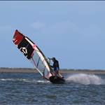
 Vid usually makes chop look smaller, but looks quite choppy in your vid. What wind strength n board speed are we looking at?