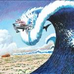
At long long last we are definitely going to get something that resembles a wave over the next few days.
Everyone has been waiting for this swell event now for 4 or 5 days. It must be the most publicised one I can remember. The surf will be busier than normal no doubt but with perfect winds and swell direction there will be enough spots firing to split the packs up nicely. Its game on fellas ! ! !
The SB chart is showing some promise at long last with a long period E swell and then our friendly forecaster Ben posted the following.

This weekend (Mar 15-16)
Couple of changes for the weekend forecast, but essentially it's all good news for surfers in southern NSW.
As has been detailed since last Friday, we've got a broad area of near-stationary trades across the southern Coral Sea, extending into the South Pacific, along with TC Lusi (currently a Cat 2 cyclone, may reach Cat 3 later today).
However model guidance has slightly sped up the southward track of TC Lusi over the coming days, and also made a minor adjustment to its core alignment and primary fetches (marginally more meridional than zonal, i.e. more north-south than east-west).
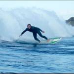
This has slightly downgraded the size potential, and also adjusted the timing of the swell. We're looking at a slowly building trade swell for much of Saturday ahead of the leading edge of long period 'cyclone swell' pushing through late afternoon. So don't be surprised to see a rapid jump in size during the last few hours of Saturday. Wave heights will then remain strong on Sunday, generally around 4-5ft at most open beaches, but with some of the region's more relable exposed swell magnets likely to see occasional bombs in the 6ft range. Due to the distant source, there will be a wait for the bigger waves.
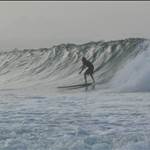
But the really good news is that the models have also sped up an advancing front from the west, with an arrival time due Sunday morning (instead of Sunday night). Saturday will see freshening nor'easters all day (so conditions will probably be average at many spots) however Sunday's looking really good with fresh NW winds tending gusty W'ly during the day. Should be excellent surf at many locations.