blueball said...
Hey Maz have you seen or have access to any annual average swell reports that go back the last 20 years?
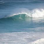
That could show if we just arent getting the same sized swells anymore.
hey blueball (sorry to read about that)
the guys in the coastal/physical oceanography group at UWA i think are working on that. They are the same ones i mentioned who have examined the intensity and tracks of storms and whether it is changing over the historical record etc. if you can get in touch with them you might get a straight forward answer, i don't have any papers on it handy, and from experience they are usually pretty scientific and i find them hard to follow, or to get the meaning from the statitical analysis etc.
try tracking someone down from here, but the website doesn't look that up to date, so could be a mission, try for a phd student first as they are usually keen to discuss their work:
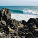
www.uwa.edu.au/ems/schools/school-of-engineering/department-of-civil-environmental-and-mining-engineeringon the trigg point/ hillary's issue, have to say i feel inclined to agree with the guys talking about the loss of dunes, and the engineering of scarbs after losing its dunes to obs city and consequent efforts to stabilise what was a massively fluctuating beach width, as more likely to be impacting on trigg point than hillary's imo. its hard to argue with what people believe they have seen with their own eyes, but i'd temper that with a gentle reminder that ones memory isn't always ones most reliable tool! i could just speak for myself on that, but i'm sure a few of crew reading here may have had a think about how memories change over time, with perspective and new experiences (remember those maaaaaaaaasive days when you were a wee grom at your local, at a beach you realise now where it can't ever get over 3 foot due to swell shadow etc

)
anyways, no need to get into the psych analysis of memory recollection, the affect of hillary's could be very real for all i know.
possibly some info on coastal sediment cells, and tie-ing that back to geological types/timeframes and classifications to be made public in coming months after a long time on the drawing board too. a breakdown of the area of interest (cape nat to moore river has been mapped) looks at:
primary cell : south mole/freo to pinnaroo point
secondary cells (within the primary close to trigg) : cott to trigg / trigg to pinnaroo (ie trigg is a nexus point of these 2 cells)
tertiary cells (even more within the secondary) : brighton road to trigg / trigg to sorrento
with the basis being the different oceanographic properties and sediment types/transport through the cells.... kind of complicated and the maps say it better than i can.
bloody mondays, wish i was still up north today...